Statement of Cultural Heritage Value or Interest (CHVI)
This is the final study area that was approved.
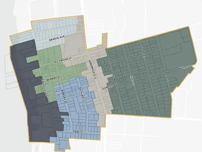
Generally, the area within the HCD Boundary represents and reflects an early to mid-19th century commercial core established along a waterway (Detroit River) with mid- to late-19th century residential neighbourhoods surrounding the core. Within the HCD Boundary, the following Character Areas have been identified: North District, Downtown, South District, Waterfront, Sandwich Street, and the East District. The character and CHVI of the HCD varies dependent on the Character Area, and as such, the following subsections provide a description and overview of the CHVI applicable to each Character Area.
For a detailed Statement of Significance please see the HCD Plan
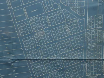
East District
The majority of the Character Area was developed with single detached dwellings constructed of wood; there were some commercial uses located near the intersection of Gore Street and Seymore Street.
In 1820, the existing town site was surveyed and extended by an additional four blocks to the east of George Street.
The East District Character Area contained a pocket of settlement of Freedom Seekers in the mid to late 19th century, known as the George-King-Seymour (GKS) Settlement.
North District
Following the disarming of Fort Malden in 1859, the reserve lands surrounding the Fort were sold in various configurations.
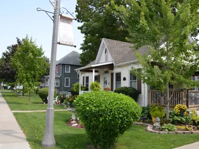
The North District Character Area was generally developed in the late 19th and early 20th century with single detached dwellings.
The original dwellings in this Area have a one to two and a half storey mass, generally have generous setbacks from the streets, and were primarily constructed in Late Victorian and Edwardian architectural styles with some Colonial-influenced buildings throughout.

Downtown District
In early 1798, 21 lots along the top of the riverbank to the south of the garrison grounds abutting William Caldwell’s land became available for building on while remaining under the ownership of the Crown.
These lots were located along First Street (now known as Dalhousie Street) and were primarily occupied by traders and merchants.
The town was laid out with lots that are 60 feet wide with a depth of 120 feet.
After the American Occupation during the War of 1812, the Town was rebuilt.
South District
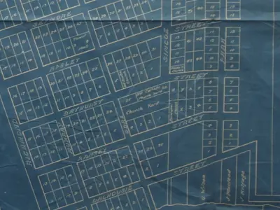
The South District Character Area generally comprises a low-rise residential neighbourhood dating to the mid-19th century.
In 1848, Thomas Park purchased land to the south of the existing development of the Town and subdivided the land into 57 lots accessed by Park Street.
Single detached dwellings constructed of wood with a one to two and a half storey mass and predominant gable roofs.
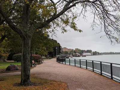
Waterfront District
This Character Area contains a mix of public (park) open space uses and vacant former industrial-type land.
The site is on the Detroit River and interacts with the Detroit River.
Landscaped open space for public use and commemoration.
Local landmarks, including: the King’s Navy Park, Commissariat Office, Park House and Pensioner’s Cottage (west side of Richmond Street).
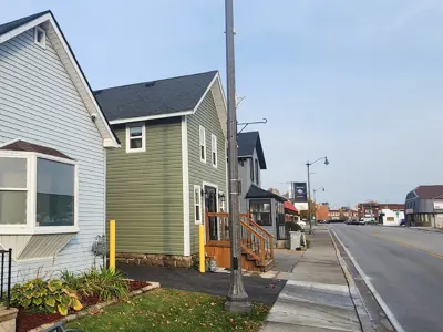
Sandwich Street District
Sandwich Street generally contains a mix of low-rise commercial and institutional uses with pockets of pre-existing residential development.
Fourth Street (now known as Sandwich Street) became available for
development in 1804.
Into the latter half of the 20th century, Sandwich Street and some of the surrounding lands were largely redeveloped with large-format commercial and service uses.
Contributing and Non-Contributing Properties

Based on the work conducted through the HCD Study process, properties were evaluated in order to determine which properties were ‘contributing’ to the character of the HCD Study Area, and which properties were ‘non-contributing’.
|
Heritage Conservation District by Character Area |
Contributing |
Non-Contributing |
Total |
% of Properties Contributing |
|
North District |
39 |
5 |
44 |
89% |
|
Downtown |
31 |
29 |
60 |
52% |
|
South District |
62 |
35 |
97 |
64% |
|
Sandwich Street District |
14 |
34 |
48 |
29% |
|
East District |
136 |
60 |
196 |
69% |
|
Waterfront District |
9 |
10 |
19 |
47% |
|
Total |
291 |
173 |
464 |
63% |
Policies and Guidelines
To guide change and conserve the character of the HCD District, Policies and Guidelines have been developed.
When a change is proposed in the HCD, a Heritage Alteration Permit (HAP) is required. The HAP ensures that the HCD Policies and Guidelines are being followed. There are exemptions to requiring a HAP.
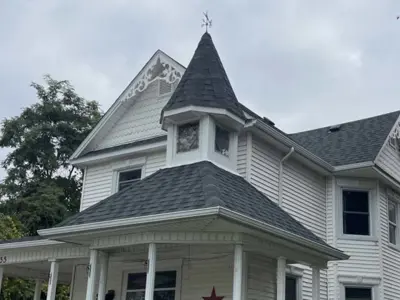
General Guidance for All Properties
This chapter of the HCD Plan includes the Policies and Guidelines related to:
Part IV Designations
Demolition and Removal of Buildings and Structures
Accessibility
Energy Conservation
Lot creation and Consolidation
Lands Adjacent to the HCD

Alterations to Contributing Properties
This chapter of the HCD Plan includes the Policies and Guidelines related to:
Foundations and Walls
Roofs
Windows
Entrances
Commercial Storefronts and Signage
Spaces Around Buildings
Removal of Building Fabric
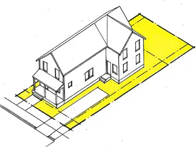
Additions to Contributing Properties
This chapter of the HCD Plan includes the Policies and Guidelines related to:
Location, Massing, and Height
Design and Cladding
Roof Types
Windows and Entrances
Outbuildings and ADUs

Non-Contributing Properties
This chapter of the HCD Plan includes the Policies and Guidelines related to:
Respecting the District's historical Character
Respecting adjacent properties in terms of scale, massing, height, and setbacks.
Additions to non-contributing buildings.
Roof Types
Exterior Cladding

Infill Development
This chapter of the HCD Plan includes the Policies and Guidelines related to:
Heritage Impacts Assessments
Compatibility with District Character
Parking garage locations
Location of entrances for Commercial Buildings.
Building Stepbacks.

Public Realm
This chapter of the HCD Plan includes the Policies and Guidelines related to:
Parks and Public Squares
Streets (lights, trees, furniture, sidewalks)
Views
Parking and Utilities
Signs
Interactive Property Guide
Download the HCD Plan or utilize the Interactive Property Guide.
